Showing posts with label Interior. Show all posts

Thursday, 28 January 2016

Iceland 2.22: Sprengisandur 2

In the middle of Sprengisandur is the oasis of Nýidalur - a green valley which was discovered by a lost traveller in 1845.  It is now the site of a hut maintained by the Icelandic Hiking Club, and a magnet for anyone travelling across this part of the interior.  Unlike the rest of the road, where we met virtually nobody, Nýidalur was actually reasonably busy: mainly with Germans and Australians.  I spent quite a while chatting to the warden, and he told me that he worked for two months in Nýidalur during the summer season, but the rest of the time he was a sports teacher in Reykjavík.


Just like Kjölur, Sprengisandur has a regular service bus which operates during the summer months.  Nýidalur also has a small airstrip which presumably is used to bring in supplies and deal with any emergencies.


The only hairy episode in our crossing of the interior happened just south of Nýidalur.  A large river must be forded, and - unusually - the path of the road was very poorly marked.  We had to make a guess as to the path we should follow, and for a while we sat on a sandbank in the middle of the river with a car which refused to go anywhere.  The four wheel drive controls, including differential lock, were "fly by wire" on the Vitara, and for some reason the onboard computer had become confused as to the car's mechanical state.  As with all computer problems, a quick "power-cycle" cleared the confusion, and we were soon on our way.  Phew!

The clouds began to build as we crossed the watershed, and was clear that there was some serious weather happening over both Hofsjökull and Vatnajökull.


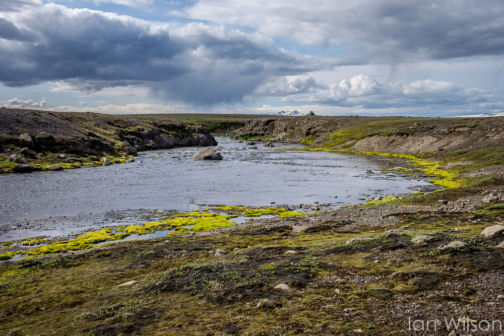
The rivers were wider - and deeper - in the southern part of the highlands too, which made for interesting driving conditions.  We were relatively comfortable in our 4x4, however - at least compared to the poor cyclists who had to navigate the freezing water on foot.  Two can just be seen in the second picture while attempting a crossing.  There was far more plant life around the rivers than we'd seen elsewhere, although between the rivers the land was still as parched as ever.


The picture here is a stitched panorama of half a dozen images, and hopefully gives some idea of the scale of the storm which was building above Hofsjökull.


As we neared our destination it was clear that we were driving into the middle of some proper Icelandic weather.  The lighting was truly amazing, with dark brooding skies just over the hill, but us still in bright sunshine.


We did, indeed, have to drive through some very heavy rain, but luckily this only happened once we had come off the F26 and onto metalled roads.  It felt very strange to be driving so fast - and so smoothly - compared to the previous 6 hours or so.  We discovered that the hotel we'd booked appeared to have been built to service a large hydro-electric project, and was actually in the middle of absolutely nowhere.  Luckily it did have its own hydrant, though, so we were able to rest easy in our beds.


Hrauneyjar is, indeed, an island of green in the middle of the lava, and was surrounded by all sorts of plant life - including the ubiquitous purple lupin.  After the exertions of the day we were both exhausted, however, so decided to hit the deck after dinner at the hotel's surprisingly good (but expensive) restaurant.


Wednesday, 27 January 2016

Iceland 2.21: Sprengisandur 1

Our stay in the north of Iceland was now over, and it was time to hit the interior again - on this occasion using the infamous Sprengisandur Route.  I wasn't especially worried about the journey while we were planning our holiday, but later I made the mistake of reading the guide book:

The official Sprengisandur road is Route F26 that goes from Mt Hekla all the way to Goðafoss; around 200km long.  Travelling this route is not for the faint-hearted, as you must cross dozens and dozens of streams and rivers.  The road varies in quality and getting stuck in sand is quite common.  Regardless of physical dangers, it also takes a special mental stamina to travel in these parts.  When you're hiking or riding across such nothingness for so long, it's hard to keep your mind from falling into a post-apocalyptic stupor.  The Icelanders add to the psychodrama with lots and lots of ghost stories about the unsettled natures in this region.  Superstitions surrounding Sprengisandur make the Kjölur route seem like a fairy tale by comparison.

So that's all good, then...

Having said goodbye to Reykjahlíð, we headed for Goðafoss.  Here we filled up with fuel, water and other emergency provisions, just in case something untoward happened while we were in the middle of nowhere.  The first part of the road, as far as Aldeyarfoss, was very well maintained and open to non-4x4 vehicles.  Easy driving, but not exactly good preparation for the rest of the day.


Aldeyarfoss is a spectacular waterfall in a canyon of columnar basalt, and as a result is very much on the tourist map.  There's even a car park with public conveniences (of sorts).  Sadly the waterfall itself would have been a 4km walk to the bottom of the valley and back, and we simply didn't have the time to visit it.  As a result, the pictures are all taken from a distance with a long lens.


Once beyond Aldeyarfoss we hit the F26 proper.  I was expecting a rough road and rivers which needed fording, but nothing quite prepared me for the desert scenery in this part of the highlands.  All the water is locked up in the ice caps, each with their own private weather system, and the result is that the whole area is completely parched.


There were small pockets of green, but these only extended a few metres either side of the many rivers we had to cross.  The rivers themselves are melt-water coming from the ice caps, so presumably only flow during the short summer season.  As we discovered, 2015 had been a particularly cold summer, meaning that the snow - which would normally have melted by the time we visited at the end of July - was in plentiful supply.  In fact, many of the highland roads were still closed owing to the amount of snow around, and others had only just opened.


No, I wasn't hallucinating: there really was a fire hydrant in the middle of the highland desert!


Navigation would have been tricky without the periodic signposts to various mountains and valleys.  It's difficult to convey the sheer scale and emptiness of this area, and it was pretty bleak even in the bright sunshine.


Occasionally - and apparently in the middle of nowhere - we would find a small plant which had managed to become established by the side of the road.


At this point we were almost half way across Sprengisandur, and we started to see signposts to our final destination: Hrauneyjar (literally, lava island).  It was the point in the road where the Askja Route splits off from the F26, but it was closed being still blocked with snow.


At this point we were very close to Nýidalur, which is a little oasis in the middle of Sprengisandur.  It boasts a couple of huts, some lavatories and even an airstrip, and it was our destination for lunch.