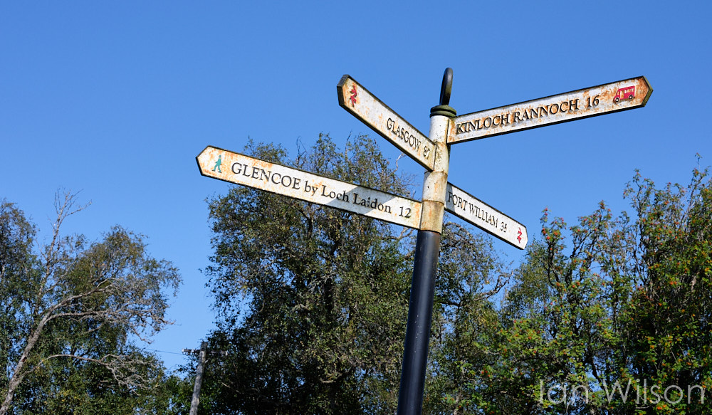
Our next accommodation after Pitlochry was in Ballachulish (near Glencoe); but, because of the expanse of Rannoch Moor, there wasn't an obvious direct route between the two. The choices were to go south, via Crianlarich, or north via Spean Bridge and Fort William. Since we had the whole day for the journey, we decided to take a slight detour and head up through Aviemore to the Loch Garten Osprey Centre. The eponymous birds have nested in Loch Garten every year since 1954, and the RSPB have installed a "nest cam" so that the chicks can be observed at close quarters without being disturbed. Sadly the birds didn't return in 2019, but our visit was far from wasted. Loch Garten is in the Cairngorms National Park, and its ancient Caledonian Pinewoods are ideal places to spot two of Scotland's iconic species: crested tit and red squirrel. After the damp squib of Mar Lodge Estate, we had high hopes that the glorious sunshine would gives us better luck this time.
I spotted a red squirrel running across the track, but didn't manage to photograph it. Perhaps our optimism would be justified after all?
The Visitors' Centre at Loch Garten is absolutely brilliant, with plenty of opportunity to watch the comings and goings on the various feeders. Photographic conditions weren't ideal, unfortunately, with extremely harsh back-lighting and perches which were obviously man-made. Even so, our patience was rewarded - briefly - when the feeding station was visited by one of the local cresties.
Other visitors were siskin, chaffinch, great tit and a juvenile spotted woodpecker.
Random postings from an itinerant engineer who would rather be taking pictures or catching trout on the fly...
Showing posts with label Highlands. Show all posts
Wednesday, 8 January 2020
Monday, 6 January 2020
Scotland 2019 22: Rannoch Moor
Having got cold and damp walking through the Mar Lodge Estate, the following day dawned with clear blue skies, virtually no wind and a predicted maximum temperature well into the 30s. Given that we still needed to escape Pitlochry because of the Blair Castle Horse Trials, we decided to head west on the banks of Loch Tummel, Dunalastair Water and Loch Rannoch to one of the most remote tea rooms in the country at Rannoch Moor Station. OK, so the official excuse was that we wanted to go for a walk on the moor and in the woods above Loch Laidon, but who can resist the Rannoch Station Tearoom? It was so good that we had to visit it twice, in fact: once on arrival (when the cakes were still hot from the oven); and again after our walk for a belated lunch.
The last time we visited Rannoch Moor was by train back in 2004, when it was wall-to-wall low cloud and rain. Fifteen years later, it couldn't have been more different.
Any hopes of capturing a picture with a train going over the viaduct were dashed when we spotted that the line was closed for maintenance work.
It was incredibly hot and very hazy for the walk, but the area was surprisingly free of midges - especially given the conditions. Not ideal for landscape photography, unfortunately, but the lack of cloud made it obvious how close Rannoch Moor is to Glencoe, which was clearly visible in the distance.
There was some respite for the heat in the woods, but this was more than made up for by having to climb up a gradient. No choice but to turn around and head for the tearoom. Again!
The last time we visited Rannoch Moor was by train back in 2004, when it was wall-to-wall low cloud and rain. Fifteen years later, it couldn't have been more different.
Any hopes of capturing a picture with a train going over the viaduct were dashed when we spotted that the line was closed for maintenance work.
It was incredibly hot and very hazy for the walk, but the area was surprisingly free of midges - especially given the conditions. Not ideal for landscape photography, unfortunately, but the lack of cloud made it obvious how close Rannoch Moor is to Glencoe, which was clearly visible in the distance.
Location:
Rannoch, Pitlochry PH17 2QA, UK
Friday, 29 January 2016
Iceland 2.23: Landmannalaugar 1
We had planned two nights in Hrauneyjar in order to have a quiet day in the highlands after the rigours of the Sprengisandur crossing. After an abortive attempt to find out about horse riding and trout fishing in the area, we decided to drive to Landmannalaugar: the northern end of the famous Laugavegur hiking trail which links the Landmannalaugar and Þórsmörk National Parks.
Although the journey from Hrauneyjar to Landmannalaugar isn't much more than 30km as the crow flies, the aforementioned corvid is somewhat hampered when forced to drive on ill-maintained F-roads. Progress was slow and very bumpy, but this was more than made up for by the scenery. On the way we spotted a lake and decided to see whether there were any birds to look at. We then discovered that we weren't the first to arrive, as there were three humongous vehicles parked by the lakeside. Harriet came up with a particularly apt phrase which describes this kind of Icelandic activity: Testosterone Tourism. We saw plenty more examples of TT later in the day.
There were plenty of rivers to be forded in this part of the world too, including a wide and deep example just outside Landmannalaugar itself. The service bus had no problems, and neither did the big, recreational 4x4s; other, more normal vehicles, were slightly more circumspect when it came to the crossing.
Unlike the previous example of Testosterone Tourism, which was Italian, the monstrosity here is Swiss. The scale of the truck is given by the full-sized motor bike which is being carried at the back, almost as an afterthought.
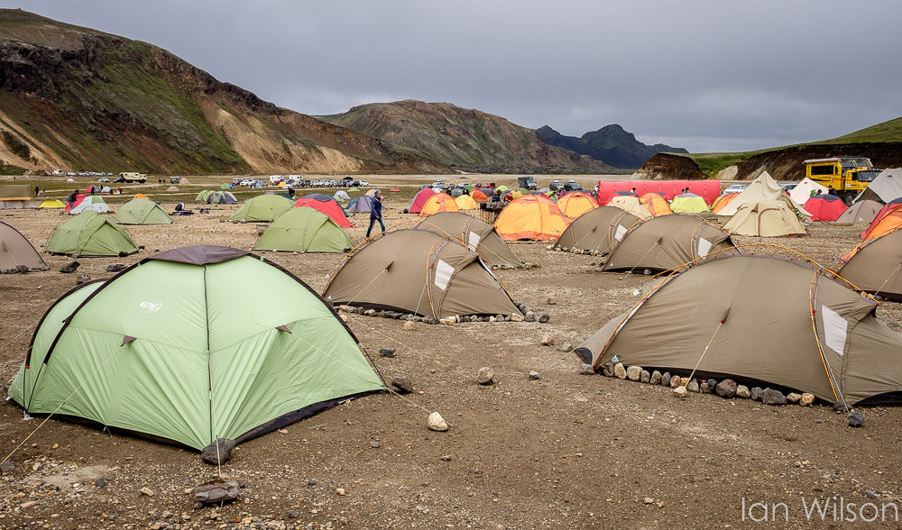
Landmannalaugar is a haven for walkers, and they were absolutely everywhere. Those doing the Laugavegur trail were being checked off as they departed or arrived, and it was clear that safety in the mountains is taken very carefully in these parts. Landmannalaugar itself is "tent city", as can be seen from the pictures.
Because we didn't want to get in the way of serious hikers, rather than following the main trail we decided to go for a walk up Grænegil (green ghyll). It certainly was green too, in stark contrast to the warm reds, yellows and oranges of the rhyolite from which Landmannalaugar is formed. This, in turn, made a very pleasant change from the interminable black basalt which covers most of Iceland.
It was cold in this part of the highlands, and there was plenty of snow to be found in the permanently shaded valleys. It was also very damp, with plenty of moss and other plants. Rather different to our experience of crossing the highland desert the previous day, in other words.
Although the journey from Hrauneyjar to Landmannalaugar isn't much more than 30km as the crow flies, the aforementioned corvid is somewhat hampered when forced to drive on ill-maintained F-roads. Progress was slow and very bumpy, but this was more than made up for by the scenery. On the way we spotted a lake and decided to see whether there were any birds to look at. We then discovered that we weren't the first to arrive, as there were three humongous vehicles parked by the lakeside. Harriet came up with a particularly apt phrase which describes this kind of Icelandic activity: Testosterone Tourism. We saw plenty more examples of TT later in the day.
There were plenty of rivers to be forded in this part of the world too, including a wide and deep example just outside Landmannalaugar itself. The service bus had no problems, and neither did the big, recreational 4x4s; other, more normal vehicles, were slightly more circumspect when it came to the crossing.
Unlike the previous example of Testosterone Tourism, which was Italian, the monstrosity here is Swiss. The scale of the truck is given by the full-sized motor bike which is being carried at the back, almost as an afterthought.
Landmannalaugar is a haven for walkers, and they were absolutely everywhere. Those doing the Laugavegur trail were being checked off as they departed or arrived, and it was clear that safety in the mountains is taken very carefully in these parts. Landmannalaugar itself is "tent city", as can be seen from the pictures.
Because we didn't want to get in the way of serious hikers, rather than following the main trail we decided to go for a walk up Grænegil (green ghyll). It certainly was green too, in stark contrast to the warm reds, yellows and oranges of the rhyolite from which Landmannalaugar is formed. This, in turn, made a very pleasant change from the interminable black basalt which covers most of Iceland.
It was cold in this part of the highlands, and there was plenty of snow to be found in the permanently shaded valleys. It was also very damp, with plenty of moss and other plants. Rather different to our experience of crossing the highland desert the previous day, in other words.
Labels:
Highlands,
Hiking,
Iceland,
Landmannalaugar,
Testosterone Tourism
Location:
Landmannalaugar, Iceland
Subscribe to:
Posts (Atom)